Track Shifts For Winter Storm Taking Aim On Northeast: New Projected Snowfall Totals Track Shifts For Winter Storm Taking Aim On Northeast: New Projected Snowfall Totals Track Shifts For Winter Storm Taking Aim On Northeast: New Projected Snowfall Totals
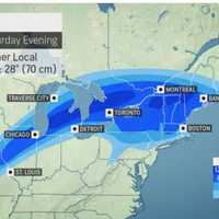
Track Shifts For Winter Storm Taking Aim On Northeast: New Projected Snowfall Totals The projected track has shifted for a new winter storm headed for the Northeast as an unsettled weather pattern arrives in the area. The current projected time frame for possible snowfall is from Friday evening, March 3 into Saturday, March 4, the National Weather Service says. Precipitation is expected to start as rainfall Friday afternoon, before changing over to a wintry mix and snow, especially in areas farther north and inland. Areas near the coast could see heavy rainfall, coastal flooding, and strong winds with gusts up to 45 miles per hour. The highest snowfall totals will be&…
School Closings: List Grows As Massachusetts Prepares For 'Hazardous' Snowfall School Closings: List Grows As Massachusetts Prepares For 'Hazardous' Snowfall School Closings: List Grows As Massachusetts Prepares For 'Hazardous' Snowfall
School Closings: List Grows As Massachusetts Prepares For 'Hazardous' Snowfall New England's subzero temperatures and heavy snowfall predictions have caused schools across Massachusetts to close for the day on Tuesday, Feb. 28.  A winter storm warning calls conditions in New England "hazardous," according to the National Weather Service.  Snowfall in parts of Massachusetts may reach up to eight inches overnight, creating hazardous conditions for commuters, according to a Tweet made by the National Weather Service Boston. Snow spreads into southern New England tonight & continues through Tue. Heaviest snowfall late tonight into early Tue AM. Will result in a h…
Here's Latest Timing, Snowfall Projections For Potent Storm Taking Aim On Region Here's Latest Timing, Snowfall Projections For Potent Storm Taking Aim On Region Here's Latest Timing, Snowfall Projections For Potent Storm Taking Aim On Region
Here's Latest Timing, Snowfall Projections For Potent Storm Taking Aim On Region A significant storm system is expected to bring hazardous driving conditions to much of the region during the evening on Monday, Feb. 27, and into the morning commute on Tuesday, Feb. 28, according to the National Weather Service. In some areas farther north, 6 inches or more of snowfall is expected. "The New York City area, as well as along the southern coast of New England, will be closer to the interface between the cold and warmer air, so a wintry mix is more likely to occur there," according to AccuWeather Senior Meteorologist and New England native Joe Lundberg. For a …
Potentially Significant Storm Could Be Coming: Wintry Blast Will Bring Separate Snow Chances Potentially Significant Storm Could Be Coming: Wintry Blast Will Bring Separate Snow Chances Potentially Significant Storm Could Be Coming: Wintry Blast Will Bring Separate Snow Chances
Potentially Significant Storm Could Be Coming: Wintry Blast Will Bring Separate Snow Chances A blast of wintry weather will lead to separate chances for snowfall through early next week, including what could be a more significant storm. Wind gusts will be as high as 30 miles per hour Saturday morning, Feb. 25 on a day in which the high temperature will be right around the freezing mark, but with wind-chill values in the teens, the National Weather Service says. There will be a band of light snow moving through from the late morning until the mid to late afternoon on Saturday. (See the first image above from AccuWeather.com.) Other areas could see a coating to an inch as well …
CT Little League Administrator Dies At 49: 'Would Drop What He Was Doing To Help' CT Little League Administrator Dies At 49: 'Would Drop What He Was Doing To Help' CT Little League Administrator Dies At 49: 'Would Drop What He Was Doing To Help'
CT Little League Administrator Dies At 49: 'Would Drop What He Was Doing To Help' A Massachusetts native who was heavily involved in the Connecticut State Little League organization has died at the age of 49.  Tolland County resident Everett Demers of Coventry died on Friday, Feb. 17 at the age of 49, according to his obituary.  Born in Worcester in 1974, Demers spent much of his childhood in Daytona Beach, Florida before coming back to New England in his late twenties where he worked for Abel Womack as a forklift manager and customer service manager.  After meeting his wife, Julie, in 2011 and marrying her in 2014, he then relocated to Coventry. It …
Brockton Eatery Serves Up Lobster Rolls, Hold The Lobster Brockton Eatery Serves Up Lobster Rolls, Hold The Lobster Brockton Eatery Serves Up Lobster Rolls, Hold The Lobster
Brockton Eatery Serves Up Lobster Rolls, Hold The Lobster A Black-owned restaurant that veganizes classic New England dishes is now open in Brockton, offering "chuna" chickpea tuna sandwiches, lobster-less rolls, and even BBQ chik'n sliders.  Cabo Vegan, a Cape Verde-inspired eatery located on Main Street in Brockton, opened on Saturday, Jan. 21 after almost two years of planning and fundraising for a brick-and-mortar storefront, according to their website.  Posted by Cabo Vegan on Sunday, January 22, 2023 The eatery, decorated with murals painted by a Boston-based artist, is currently only offering takeout options, all of which are completely…
New Projected Track Released For Slow-Moving Weekend Storm New Projected Track Released For Slow-Moving Weekend Storm New Projected Track Released For Slow-Moving Weekend Storm
New Projected Track Released For Slow-Moving Weekend Storm A new predicted track has been released by forecasters for a slow-moving storm that will move from west to east over the weekend. The timing for the storm is late Sunday night, Feb. 12 into Monday morning, Feb. 13. The latest projected path now has the bulk of the system staying south and not affecting areas farther north and inland, though there could be mixed precipitation in the New York City tristate area, according to the National Weather Service. But there's still a chance it could bring a touch of snow at the last minute before heading out to sea, according to AccuWeather.com. "Sh…
After Record Cold, Expect Warmer-Than-Normal Temps Across Massachusetts: NWS After Record Cold, Expect Warmer-Than-Normal Temps Across Massachusetts: NWS After Record Cold, Expect Warmer-Than-Normal Temps Across Massachusetts: NWS
After Record Cold, Expect Warmer-Than-Normal Temps Across Massachusetts: NWS One of the coldest nights on record will soon give way to warmer-than-usual temperatures on Sunday, Feb. 5, meteorologists said.  Massachusetts — and most of New England — suffered arctic conditions Friday night and Saturday as thermometers fell below zero in several parts of the state because of the polar vortex, the National Weather Service said. Boston and Worcester broke records more than 100 years old with minus 8 and minus 10 degrees, respectively. But that's almost balmy compared to the minus 40 degrees it felt in some parts of the state with the wind chill.  🥶 Record cold was ac…
Iconic Vernon Deli To Close For Renovations: Here's When It Will Reopen Iconic Vernon Deli To Close For Renovations: Here's When It Will Reopen Iconic Vernon Deli To Close For Renovations: Here's When It Will Reopen
Iconic Vernon Deli To Close For Renovations: Here's When It Will Reopen A beloved Vernon deli frequented by sandwich lovers from across the area is set to close so that renovation work can be completed.  Rein's Deli, located at 435 Hartford Turnpike (Route 30), announced that it will close starting on Sunday, Feb. 5 at 3 p.m. for the renovations, according to a social media post.  The closure will last for a little more than a week, with the eatery set to reopen on Monday, Feb. 13 at noon.  The renovations will include the installation of new equipment in addition to epoxy floors for the kitchen and takeout areas.  Opened in 1972 by B…
Accumulating Snow Possible In Parts Of Northeast From Quick-Moving System Accumulating Snow Possible In Parts Of Northeast From Quick-Moving System Accumulating Snow Possible In Parts Of Northeast From Quick-Moving System
Accumulating Snow Possible In Parts Of Northeast From Quick-Moving System A quick-moving system is expected to bring precipitation to the Northeast, with snowfall possible in some areas farthest north and inland. After a mostly sunny start to the day on Monday, Jan. 30, skies have been cloudy in the afternoon.  The temperature, which reached a high in the upper 40s, will drop rapidly in the evening and through the overnight into Tuesday morning, Jan. 31. Precipitation is expected to be scattered and begin mainly later in the evening Monday, with areas farther south seeing scattered showers before the system moves out before daybreak Tuesday. Some spots in …
New Storm Will Bring Accumulating Snowfall, Cause Slippery Travel Conditions: Here's Latest New Storm Will Bring Accumulating Snowfall, Cause Slippery Travel Conditions: Here's Latest New Storm Will Bring Accumulating Snowfall, Cause Slippery Travel Conditions: Here's Latest
New Storm Will Bring Accumulating Snowfall, Cause Slippery Travel Conditions: Here's Latest A brand-new storm will bring widespread accumulating snowfall to the region and cause slippery travel conditions. It's due to arrive during the day Wednesday, Jan. 25. It could dump up to a foot of snow across some interior areas, with generally around 2 inches of accumulation around the I-95 corridor, unlike the first storm of this week, according to AccuWeather.com.  If it happens, it would be the first measurable snowfall of the 2022-23 season in New York City. The currently projected timing for the system has it moving from west to east starting around midday Wednesday, the N…
First Projected Snowfall Totals Released For Midweek Storm Taking Aim On Region First Projected Snowfall Totals Released For Midweek Storm Taking Aim On Region First Projected Snowfall Totals Released For Midweek Storm Taking Aim On Region
First Projected Snowfall Totals Released For Midweek Storm Taking Aim On Region Just as a complex system that brought a mix of rain and sleet, and as much as a foot of snow or more in some spots moves east, the first projected snowfall totals have released for a second storm on track for the Northeast midweek. It's due to arrive Wednesday, Jan. 25, and could deliver more snow across interior areas, but also perhaps even closer to the I-95 corridor, unlike the first storm this week, according to AccuWeather.com. The currently projected timing for the system has it moving from west to east starting in the middle of the afternoon on Wednesday, according to the N…